Peyresourde and Aspin from Luchon
88 km · 2,650 m · Bagnères-de-Luchon
- Base
- Bagnères-de-Luchon
- Distance
- 88 km
- Elevation gain
- 2,650 m
- Difficulty
- Hard
- Type
- Out and back
- Highest point
- Col de Peyresourde, 1,569 m
- Cols
- Col de Peyresourde (1,569 m), Col d'Aspin (1,489 m)
- Season
- June–October
Two of the Tour de France's most-used cols, and they've featured since the first Pyrenean stage in 1910. From Luchon the Peyresourde is 13.8 km with 949 metres of climbing, a steady climb via Saint-Aventin and Garin with beautiful views towards the snow-capped peaks to the south. The other side down towards the Louron valley and Arreau is shorter. The Aspin from Arreau (12 km, 779 hm) goes through forest and ends on open pasture with cows and one of the finest views in the Pyrenees. The way home over the Peyresourde from the Arreau side is a proper final climb.
TipsCrêperie and café at the top of the Peyresourde, an ice-cream kiosk and sometimes food on the Aspin. Food and water in Arreau, which is a nice village for lunch. Both cols are closed in winter (roughly November–May; the Peyresourde is sometimes kept open to the Peyragudes ski resort). Add the lake at Payolle behind the Aspin if you want to extend the ride.
Nearby
- Bagnères-de-LuchonSpa and mountain town, often a TdF finish
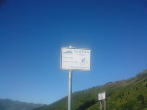 Col d'AspinA green col with cows and views of the Pic du Midi
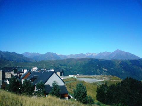 Col de PeyresourdeTdF country just west of Luchon
 LoudenvielleThe lake and outdoor activities of the Vallée du Louron
 PeyragudesA finish on the airfield
- BalnéaThe largest thermal spa in the Pyrenees
- Espace nordique de PayolleVallée de Campan, Hautes-Pyrénées
 Val LouronVallée du Louron (Génos), Hautes-Pyrénées
Cycling rides
- Gavarnie from Luz-Saint-Sauveur40 km · 700 m · Easy
- Cerdagne loop over the Col de la Perche55 km · 800 m · Easy
- Aubisque and Soulor from Laruns55 km · 1,550 m · Moderate
- Col de Marie-Blanque loop from Arudy60 km · 1,000 m · Moderate
- Col du Pourtalet to Formigal and Sallent82 km · 1,800 m · Moderate
- Port de Larrau and Pierre-Saint-Martin, French–Spanish loop127 km · 3,000 m · Very hard
- The Tourmalet from both sides72 km · 2,700 m · Hard
- Hautacam and Luz Ardiden102 km · 2,550 m · Hard
- The Tour's 65-kilometre stage: Luchon–Col de Portet65 km · 3,000 m · Hard
- Port de Balès and Peyresourde from Luchon88 km · 2,300 m · Hard
- The big Comminges loop: Ares, Balès, Menté and Portet d'Aspet133 km · 3,300 m · Very hard
- Col de Port and Mur de Péguère from Foix74 km · 1,750 m · Hard
- Latrape, Saraillé and Col d'Agnes from Aulus76 km · 1,950 m · Hard
- The Pailhères from both sides and Ax 3 Domaines75 km · 2,850 m · Hard
- Coll d'Ordino and Beixalís from Andorra la Vella62 km · 1,700 m · Moderate
- Port de la Bonaigua from Vielha46 km · 1,150 m · Moderate
- The queen stage Pau–Luchon (the Circle of Death in reverse)197 km · 4,800 m · Very hard