The Pailhères from both sides and Ax 3 Domaines
75 km · 2,850 m · Ax-les-Thermes
- Base
- Ax-les-Thermes
- Distance
- 75 km
- Elevation gain
- 2,850 m
- Difficulty
- Hard
- Type
- Out and back
- Highest point
- Col de Pailhères, 2,001 m
- Cols
- Col de Pailhères (2,001 m), Ax 3 Domaines (Plateau de Bonascre) (1,380 m)
- Season
- June–October
The Pailhères is Ariège's two-thousand-metre col and one of the most beautiful climbs in the whole of the Pyrenees: 18.6 km and 1281 metres of climbing from Ax, where the last kilometres wind in hairpins across bare mountain moorland. The eastern side down towards Mijanès in the Donezan is steeper (10.6 km at 8.2 per cent) and has to be climbed on the way back. The day finishes with Ax 3 Domaines, 7.8 km at 8.6 per cent, which has been a Tour finish many times (including 2003 and 2013, both times after the Pailhères).
TipsNo services on the Pailhères; fill up with water in Ax and at the fountain in Mijanès. Ax-les-Thermes has hot springs, perfect for ending the day. The col is closed by snow roughly November–May and can be cold and windy even in summer. Shorter alternative: just the Pailhères from Ax and back (37 km, 1300 hm). Plateau de Beille (1790 m, 15.8 km at almost 8 per cent from Les Cabannes) is 20 minutes away and suits another day.
Nearby
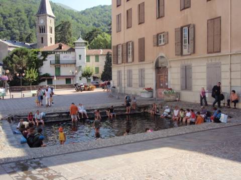 Ax-les-ThermesA spa town with fantastic baths
- Mijanès-DonezanDonezan, Ariège
- Port de Pailhères2 001 metres above Ax
 Ascou-PailhèresAscou, Haute-Ariège, Ariège
 Ax 3 DomainesA steep climb to the Bonascre ski resort
 Le ChioulaPays d'Ax, Ariège
 Col du ChioulaThe viewpoint pass above Ax-les-Thermes
 CamuracPays de Sault, Aude
Cycling rides
- Gavarnie from Luz-Saint-Sauveur40 km · 700 m · Easy
- Cerdagne loop over the Col de la Perche55 km · 800 m · Easy
- Aubisque and Soulor from Laruns55 km · 1,550 m · Moderate
- Col de Marie-Blanque loop from Arudy60 km · 1,000 m · Moderate
- Col du Pourtalet to Formigal and Sallent82 km · 1,800 m · Moderate
- Port de Larrau and Pierre-Saint-Martin, French–Spanish loop127 km · 3,000 m · Very hard
- The Tourmalet from both sides72 km · 2,700 m · Hard
- Hautacam and Luz Ardiden102 km · 2,550 m · Hard
- Peyresourde and Aspin from Luchon88 km · 2,650 m · Hard
- The Tour's 65-kilometre stage: Luchon–Col de Portet65 km · 3,000 m · Hard
- Port de Balès and Peyresourde from Luchon88 km · 2,300 m · Hard
- The big Comminges loop: Ares, Balès, Menté and Portet d'Aspet133 km · 3,300 m · Very hard
- Col de Port and Mur de Péguère from Foix74 km · 1,750 m · Hard
- Latrape, Saraillé and Col d'Agnes from Aulus76 km · 1,950 m · Hard
- Coll d'Ordino and Beixalís from Andorra la Vella62 km · 1,700 m · Moderate
- Port de la Bonaigua from Vielha46 km · 1,150 m · Moderate
- The queen stage Pau–Luchon (the Circle of Death in reverse)197 km · 4,800 m · Very hard