Latrape, Saraillé and Col d'Agnes from Aulus
76 km · 1,950 m · Aulus-les-Bains
- Base
- Aulus-les-Bains
- Distance
- 76 km
- Elevation gain
- 1,950 m
- Difficulty
- Hard
- Type
- Loop
- Highest point
- Col d'Agnes, 1,570 m
- Cols
- Col de Latrape (1,110 m), Col de Saraillé (942 m), Col d'Agnes (1,570 m)
- Season
- June–October
One of the finest loops in the Ariège Pyrenees, based in the little spa town of Aulus-les-Bains. First the short Col de Latrape (5 km), then down through the Ustou and Salat valleys and over the wooded Col de Saraillé to Massat. The finale is the long Col d'Agnes via Le Port and the Étang de Lers lake: 17.6 km and 921 metres of climbing, where the last stretch across the open pastures after the Port de Lers is the most beautiful in all of Ariège. The Agnes, Lers and Latrape have often been combined in Tour de France stages to Foix and Saint-Girons.
TipsCafés and restaurants in Oust/Seix and Massat, water at the Étang de Lers (auberge in summer). Ride clockwise as described and you get the steepest side of the Agnes (from Aulus, 8 per cent) as a descent, or reverse the loop if you want the real challenge. The Agnes is closed in winter, roughly November–May. Small, quiet roads but a poorer surface in places. Watch out for cows and sheep on the road.
Nearby
- Aulus-les-BainsA spa village at the end of the valley
- Col d'AgnesA high-mountain road between Lers and Aulus
- Cascade d'ArsOne of the most beautiful waterfalls in the Pyrenees
- Port de Lers & Étang de LersA mountain lake and free-roaming horses above Massat
 Espace nordique de l'Étang de LersCouserans/Vicdessos, Ariège
 GuzetUstou, Couserans, Ariège
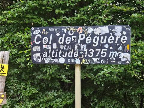 Col de PéguèreThe Mur's steepest metres above Foix
Cycling rides
- Gavarnie from Luz-Saint-Sauveur40 km · 700 m · Easy
- Cerdagne loop over the Col de la Perche55 km · 800 m · Easy
- Aubisque and Soulor from Laruns55 km · 1,550 m · Moderate
- Col de Marie-Blanque loop from Arudy60 km · 1,000 m · Moderate
- Col du Pourtalet to Formigal and Sallent82 km · 1,800 m · Moderate
- Port de Larrau and Pierre-Saint-Martin, French–Spanish loop127 km · 3,000 m · Very hard
- The Tourmalet from both sides72 km · 2,700 m · Hard
- Hautacam and Luz Ardiden102 km · 2,550 m · Hard
- Peyresourde and Aspin from Luchon88 km · 2,650 m · Hard
- The Tour's 65-kilometre stage: Luchon–Col de Portet65 km · 3,000 m · Hard
- Port de Balès and Peyresourde from Luchon88 km · 2,300 m · Hard
- The big Comminges loop: Ares, Balès, Menté and Portet d'Aspet133 km · 3,300 m · Very hard
- Col de Port and Mur de Péguère from Foix74 km · 1,750 m · Hard
- The Pailhères from both sides and Ax 3 Domaines75 km · 2,850 m · Hard
- Coll d'Ordino and Beixalís from Andorra la Vella62 km · 1,700 m · Moderate
- Port de la Bonaigua from Vielha46 km · 1,150 m · Moderate
- The queen stage Pau–Luchon (the Circle of Death in reverse)197 km · 4,800 m · Very hard