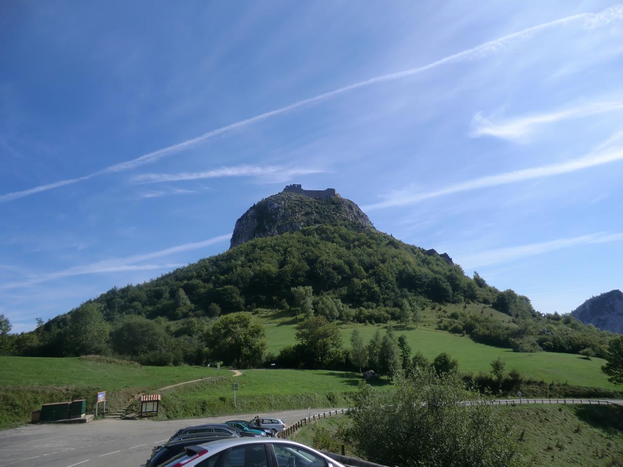
Château de Montségur
The Cathars' stronghold
The siege ended in March 1244, when just over 200 Cathars were burnt at the stake. The path up takes 30–45 minutes and is steep – wear good shoes. The Col de Montségur (1 059 m) is part of the 2026 TdF stage Carcassonne – Foix.
Day hike
- Starting point
- The car park below the castle
- Distance
- approx. 1.5 km return
- Elevation gain
- 150 hm
- Time
- 1 h
- Level
- Easy
- Season
- all year
A steep path up to the castle on top of the mountain. At the start of the path, at the Prat dels Cremats, stands the memorial to the Cathars burned in 1244. For a longer hike: the Sentier Cathare stage Montségur – Roquefixade, 18 km.
The history of the Cathars
Montségur was rebuilt in 1204 as a refuge for the Cathar clergy and in 1232 became the seat of their church. After the murder of the inquisitors at Avignonet in 1242 the mountain was besieged for ten months. On 16 March 1244 around 220 Cathars were burned at the foot of the mountain. The ruin you see today was built after the siege.
UNESCO World Heritage
Royal Capetian Fortresses of Languedoc
- World Heritage since
- 2026
Eight fortresses that the French kings built or rebuilt in the 13th and 14th centuries after the Albigensian Crusade, to hold the border with the Kingdom of Aragon: the castle in Carcassonne and seven sentinels on rocky ridges – Aguilar, Lastours, Montségur, Peyrepertuse, Puilaurens, Quéribus and Termes. They are often called Cathar castles, but the walls you see today are mostly the king's, built after the fall of the Cathars. World Heritage since July 2026.
Visit: All the castles charge an entrance fee and sit on steep summits – allow a 15–45 minute walk uphill in sun and wind. Peyrepertuse and Quéribus may close when the tramontane is blowing hard.
42.8756° N, 1.8322° E
Trails passing here
Road trips passing here
Nearby
 Fontaine de Fontestorbes8 km · The breathing spring – near Bélesta
.jpg?width=500) Les Monts d'Olmes8 km · Montferrier, Pays d'Olmes, Ariège
Les Monts d'Olmes8 km · Montferrier, Pays d'Olmes, Ariège Château de Roquefixade10 km · A clifftop ruin between Foix and Montségur
 Montaillou11 km · The last Cathar village
 Les Aigles du Château de Lordat13 km · Tame eagles – fantastic
 Le Chioula13 km · Pays d'Ax, Ariège
 Col du Chioula13 km · The viewpoint pass above Ax-les-Thermes
 Camurac14 km · Pays de Sault, Aude